

Why would the USDA need a map like this for the whole world? Sus.
E: Lots of down votes but nobody has a good answer eh?
The USA does not produce agricultural products in a vacuum. We live in a time of global markets requiring global intelligence to support the decisions of local agriculture. The war in Ukraine has been a pretty clear lesson on that topic.
Also, the US has a history of building and supporting infrastructure projects that are global in reach and benefit, even if they were executed with American interests first. This mostly takes the form of global scientific data products made public. GPS is another high profile project originally designed to benefit the U.S. and later made publically available not just to U.S. citizens and interests, but globally public.
Why do they do it? Obviously because the U.S. is an evil empire bent on global dominance and destruction. /s
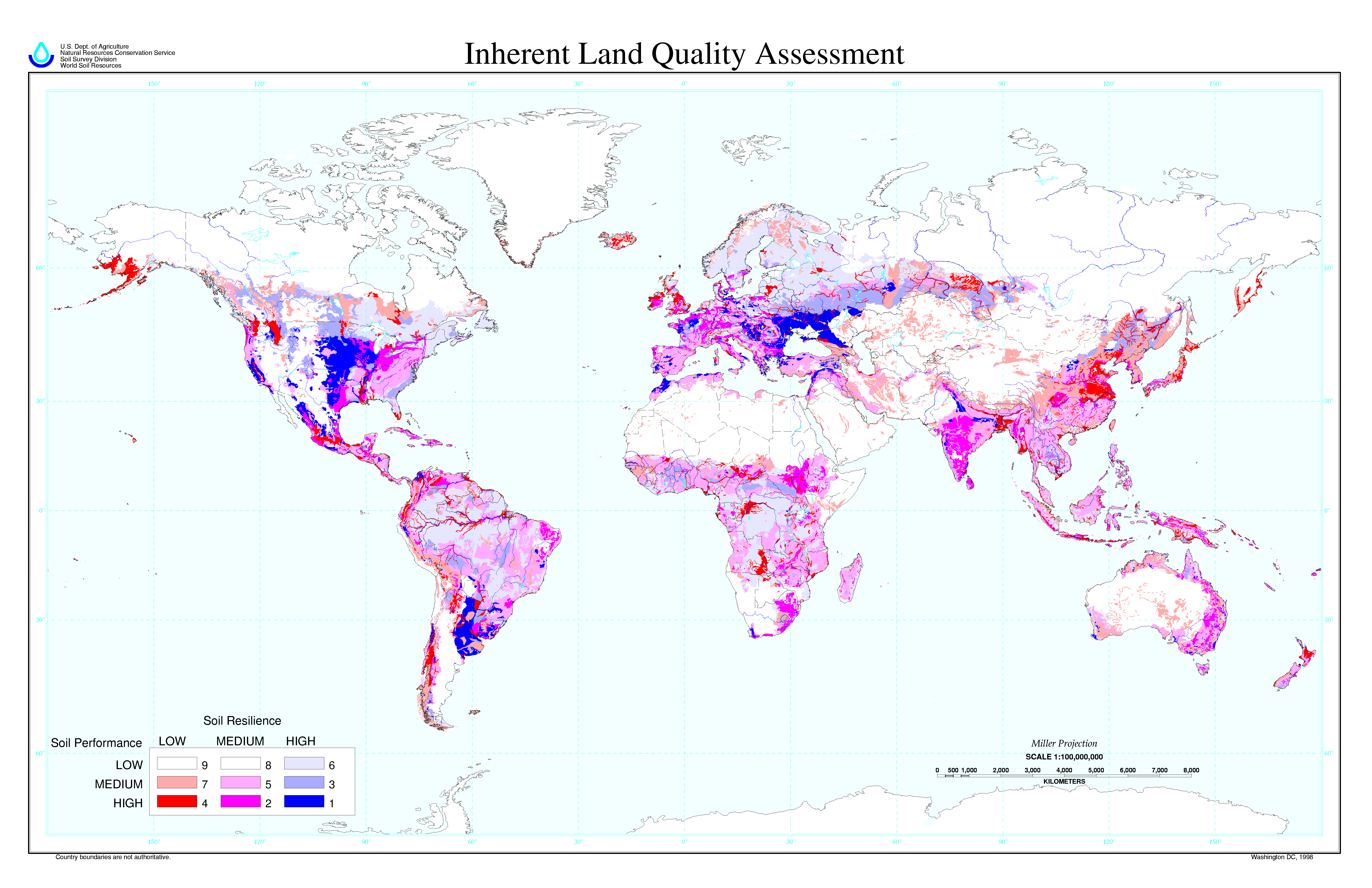
I tried to swap the awful colormap… I don’t know if it’s any better, I hope so!
https://images2.imgbox.com/fa/00/CEWRzviK_o.png
Edit: ah, the rivers were already blue…
Wtf is this colour key
Yeah, definitely not the best
Shows well why Ukraine is so important as an exporting farming country, they’ve got a lot of the green.


